The hamlet of Swanson, Saskatchewan, Canada, is located on the Canadian National Railway about70 km southwest of Saskatoon along Highway 45.


Photos of Swanson, Saskatchewan, from the family collection


Information from other sources
Canada-Rail

Prairie Towns

The photo was likely taken from the railway water tower located NE of the Railway Station. The stores pictured across the intersection from the RR Station are as follows starting from the far left of the photo.
- Hotel operated by Mr. Belton & Sydney Pipe
- Chinese Laundry operated by Joe Lee
- General Store & Post Office operated by T.E. Warner
- Swanson Mercantile operated by Mr. Stone & Mr. Cosgrove
- Colley Hardware operated by Thomas Colley (It also housed Skjeie Meat Market)
rounding the corner … the long building was * Dalton Wall Lumber Yard.
On a March night in 1921 a fire fanned by high winds destroyed all the buildings marked with an * above. Most were never rebuilt. Other businesses (not pictured, across the street, from those above escaped the fire). Fortunately, none of the Swanson residences were burned in that fire. However, several families were left homeless due to the fact that they lived in quarters at the back of their family’s business.
Post office opened on June 1, 1907. Closed on February 26, 1976.
Historical information courtesy of Pat Girwing
Saskatchewan History Album
Walter Sutherland
Walter and Ruth Sunderland came to Winnipeg, Manitoba, from England in 1904. A year later, brother Abram arrived, and in April, 1906, they moved to homestead north of Swanson, Saskatchewan on Section 12-32-9-W3.
We have many happy memories of our childhood days in Swanson: like Ethel’s first day of school. The teacher closed the classroom door, and it locked. So, Ruth drove the horse and buggy near the school window where Ethel and Mack Gilmour crawled in through the window. There were many times when the boys of the school hung Vera out the school window, and then waited until they saw the teacher coming back from lunch before they would haul her in again.
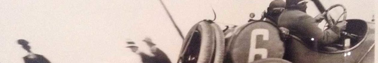
In the winter of 1912, Ruth took Ethel and Vera in to Swanson to see a traveling picture show, held in Anderson’s Hall above the hardware store. During the evening, the film caught fire. The audience all escaped, but the camera operator was badly burned trying to put out the fire.
Our first recollection of radio was listening, with ear phones on, at Mr. and Mrs. Charlie Wooltorton’s. Each of us had a turn for five minutes. Mrs. Wooltorton always had icing sugar sandwiches for lunch.
Sunderland and Beaton family plots are located in St. Ambrose Cemetery, southwest of Swanson.
William Beaton
William Beaton, the youngest member of a family of eleven, was born in Milan, Quebec, in 1877. His parents and grandparents had come with other Scottish settlers in 1840 from Stornoway, Isle of Lewis.
In 1902, he went to North Dakota, where he farmed. In 1905 he took a homestead south of Wiseton, Saskatchewan. He left when a rerouting of the proposed CNR left his land far from the proposed town site. He bored many wells in the Wiseton, Hanley and Dundurn areas, and also broke many broncos. In 1907 he bought land in the Ardath-Swanson district, and in 1909 married Florence Sunderland, whose family lived north of Swanson. William and Florence resided on S. E. 21-31-9-W3 until 1935 when they moved to S. E. 28-31-0.
Florence had come to Swanson in 1906 with her parents Edward and Elizabeth, to visit her brothers Abram and Walter (Ruth).
Provincial Archives of Saskatchewan
Homestead Records
Tp. 031 Rg. 08 W3
Swanson, Abraham D. : NW 30-31-08-W3
Swanson, Abraham D. : NE 30-31-08-W3
Swanson, Selmer : NE 19-22-12-W3
Swanson, Selmer : NW 5-34-02-W2
Swanson, Clarence : NE 5-34-02-W2
The land system in western Canada that was based on a grid survey developed for the Prairies by the Canadian government. The basic unit of the survey was the 36-square mile township that was divided into 36 sections. Each section was about one square mile (640 acres) and were divided into four quarters or into sixteen legal sub-divisions. Townships were numbered from south to north starting at the United States border, and numbered from 1 to 129. Ranges in Saskatchewan and Alberta (and parts of British Columbia) are numbered from east to west starting from each meridian, and ranges are numbered 1 to 34. Surveyors established seven meridians, which acted as baselines for surveying and numbering the townships.
W3 = UF West of 3rd Meridian
Do you have any information on a Horn family that lived in the area? I married Brad Horn who’s grandfather homesteaded in that area. His name was Frank Horn, married Rose and had 2 boys ray and james. We are told he had a dairy farm or maybe just a farm.
Hi April,
I also would like to know something about the Horn-Family, please contact me, Frank Horn was the brother of my Austrian grandmother.
I went to public school in Swanson at the same time as Raymond & James Horn. I was a year or two younger than James. (We called him “Jimmy”). They were from a farm located about 2 – 3 miles west of Swanson. They did indeed milk cows and shipped the cream to a creamery in Saskatoon as did most of the farm families around Swanson in the 1950’s and 60’s. Most of the farms in that area also grew wheat, fall rye and barley crops as well as having a small herd of beef cattle. I new Frank Horn tool, but do not recall his wife Rose. She must have passed when the boys were quite young.
I believe Ray was killed in a motor vehicle/train collision at Delisle Sk in the early 1970’s. I have not seen James since about the early 1970’s. Last I heard, he lived in Rosetown Sk.
It is quite likely that Frank & Rose are buried in the St. Ambrose cemetery south west of Swanson. (My parents are buried there.) I wll look through my old photos to see if I have any of the Horn boys.
Hi Pat , this is RoseMarie Horseman ( nee Johnson):
Ray & Jim Horne are both in a picture on page 277 in ‘Through the Years Delisle ,Donovan ,Gledhow & O’Malley ,Laura ,Swanson’….the book that the Delisle Womens Institute produced in 1972. I have a copy.
If you would like it,let me know & I will send you mine.